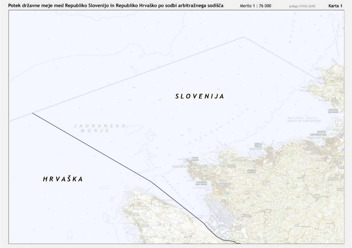


The arbitration tribunal has given the exact coordinates only for the maritime border line, which until now was not determined. According to the arbitration award Slovenia is entitled to 81 percent of the surface of the Bay of Piran.
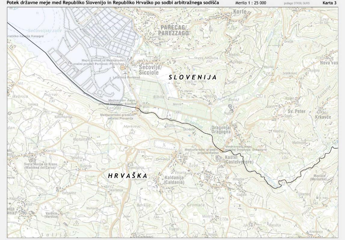
The second biggest change is the border line along the Dragonja River. According to the tribunal’s ruling the border now runs along the middle of the river.
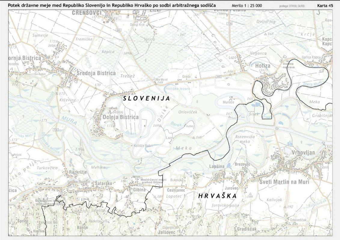
In determining the land border the tribunal mostly followed existing entries in the land registries of both countries, Slovenia and Croatia. In the case of Mirišče, the surveying and mapping authority followed the arbitration award and drew the border line on the right side of the frontier road.
The majority of the land border between Slovenia and Croatia, around 670 kilometers long, was never contentious as the land registries of both countries matched each other for the most part.
So is the case with Brezovica, - with the Croatian enclave - ,which for the most part remains in Slovenia. But this particular case, as in the division of Razkrižje in the Prekmurje region, calls for a bilateral solution. However, the two countries can only reach a solution once they implement the arbitration award. The new border drawn on the map by Slovenia’s surveying and mapping authority is also not final. On the basis of the ruling both sides will have to place boundary markers at the new border points, and only then will they be registered in the final maps. If no deal is reached, Slovenia will use this temporary map.
In the future the new maps will be used as a basis in determining the borders in other official documents, and will help the preparation of all other official maps, including those drawn in school textbooks.